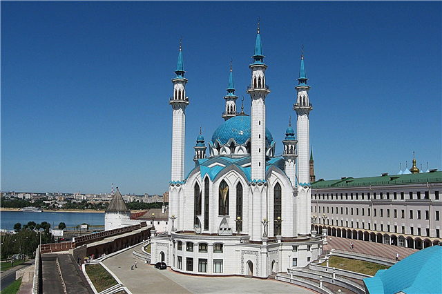
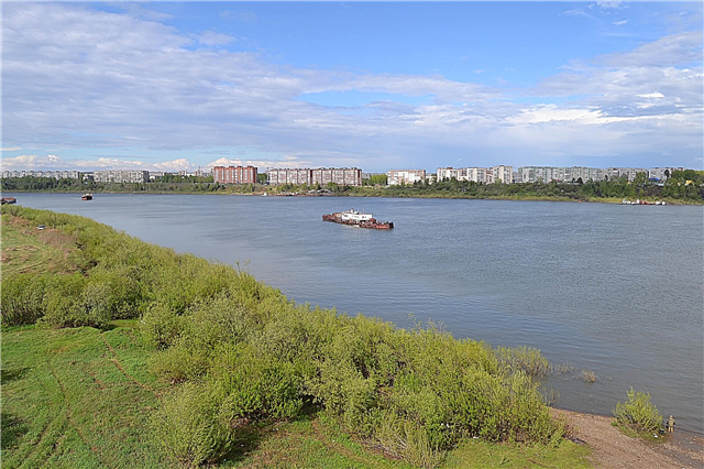
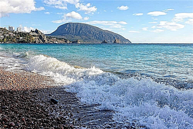
There are millions of rivers in Canada. Almost all northern rivers are covered with ice during the cold season. Due to the diversity of the Canadian relief, there are fast mountain rivers and deep plain rivers on the territory of the country. Thousands of fishermen from all over the world come to Canada in search of good fishing spots.
Ordinary tourists are attracted by the river for its picturesque landscapes and the possibility of river cruises throughout the country. The Canadian government is aware of the importance of water resources for humans and for the entire ecosystem. Therefore, many reservoirs, including rivers, are included in the list of nature conservation objects. Rare species of fish are preserved here, and the pristine nature of Canada is maintained.
Longest rivers in Canada
List of the largest waterways in the country.
Yukon
One of the largest rivers in the North American continent originates in Lake Marsh. Most of the Yukon is located in the United States, but the source is located in the Canadian province of the same name. The tributary of the Yukon, the Klondike, is famous for the "gold rush" of the 20th century. Almost the entire river is located in the subarctic climate zone, but the Canadian part of the Yukon is much warmer than in the north.
The total length of the river is 3190 km.

Colombia
The source of the river is Lake Columbia in the Rocky Mountains. Due to its fast current and large vertical drop, Colombia is actively used to generate electricity. There are 14 hydroelectric power plants on it. The river is a spawning ground for many salmon species. Dams and hydroelectric power plants impede the movement of both adults and fry, but all power plants have fish passages, and fry in some cases are transported to the ocean by the US army.
The total length of the river is 2000 km.

Pease
The river basin was formed by a glacier about 10 thousand years ago. Peace River originates in Williston Reservoir. Thanks to a hydroelectric power station built on the river in the middle of the 20th century, regular floods stopped and the development of agriculture and industry accelerated. The Peace River and the Athabasca River together form a picturesque delta that is the largest in North America.
The length of the river is 1923 km.

Mackenzie
The largest river in length and full-flowing within the territory of Canada originates in the Great Slave Lake. It belongs to the basin of the Arctic Ocean; most of the river freezes over for the winter. The southern regions of Mackenzie are navigable and play an important role in the Canadian economy. There are many industrial centers and river ports here.
The length of the river is 1738 km.

Churchill
Thanks to an artificial canal built in the 20th century, most of the water from the Churchill River goes to Saskatchewan to increase power generation at the hydroelectric power station. The river originates in central Saskatchewan and flows eastward into Hudson Bay. The rich flora and fauna of the river basin became the reason for her nomination for inclusion in the List of Protected Rivers of Canada.
The length of the river is 1609 km.

South Saskatchewan
It is the southern part of the Saskatchewan River. It originates in the Rocky Mountains, and therefore, the area near the source of the river has a fast flow. In the prairie zone, South Saskatchewan slows down and becomes more full-flowing. The river is mainly fed by melt water from mountain glaciers. Medicine Hat and Saskatoon are located on the shores of South Saskatchewan.
The length of the river is 1392 km.

Fraser
The relief and nature of the river was investigated in the 19th century by Simon Fraser, after whom it was named. Its source is located in Mount Robson National Park. Fraser passes through many gorges and canyons. In some places, its banks rise up to 50 meters above the level of the river. Since 1998, Fraser has been included in Canada's List of Protected Rivers.
The length of the river is 1370 km.

North Saskatchewan
The river begins with a glacier in the Rocky Mountains. Abraham Reservoir is located in North Saskatchewan. The river passes through the provinces of Alberta, Saskatchewan and Manitoba. The flora and fauna of North Saskatchewan are rich in steppe and forest species. Thanks to this, since 1989, the river has been included in the List of Protected Rivers of Canada.
The length of the river is 1287 km.

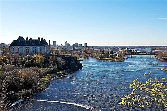
Ottawa
The largest tributary of the St. Lawrence River is located in southeastern Canada and flows through Banff National Park. 7 hydroelectric power plants have been built on the river. Waterfalls abound in the upper reaches of Ottawa. Therefore, only the lower part is navigable. During floods, the water level in the river rises significantly. The depth of the river in some areas reaches 200 meters.
The length of the river is 1287 km.

Athabasca
The glacier is the beginning of the river flowing into Lake Athabasca. Its source is located in Jasper National Park, and most of the giant joint delta with Peace River is in Wood Buffalo Park. 168 kilometers of the Athabasca River, since 1989 have become one of the objects on the List of Protected Rivers of Canada due to its rich nature and great ecological significance.
The length of the river is 1231 km.

St. Lawrence River
The most important river in southern Canada connects the Great Lakes with the Atlantic Ocean. The river became the main transport route for the first Canadian settlers, so the largest cities in the country were formed in its basin. Ottawa, Montreal and Toronto are located on its shores. Due to the proximity of the Atlantic Ocean, fin whales, whales and beluga whales are found in the river.
The length of the river is 1197 km.

Liard
The lowest point of the Canadian Rockies, the river flows from the Pelly Mountains to the Mackenzie River. The river basin is home to a large number of rare species. Liard passes through Nahanni National Park. Here the nature of the river is especially rich. One of the rarest species found on the banks of the Liard River is the forest bison.
The length of the river is 1115 km.

Assiniboine
The river got its name from the indigenous tribe of the Indians. The Assiniboin tribe lived in the provinces of Saskatchewan and Manitoba until the 20th century. Assiniboine flows through both mountainous and flat terrain. Near Winnipeg, it flows into the Red River near Lake Winnipeg. Very often the river overflows and joins Lake Manitoba.
The length of the river is 1070 km.

Albany
Lake Cat gives rise to a river that stretches across the northwestern part of Ontario. In winter, most of the river freezes and it becomes possible for heavy vehicles to move along it. Albany is crossed by many lakes, there are many rapids in the upper reaches, and closer to the mouth it slows down. The name of the river was given in honor of James II, King of England, who also had the title of Duke of Albany.
The length of the river is 982 km.

Severn
Most of the river is located in the province of Ontario, but a small section is located in Manitoba. The Severn was used to connect Lake Winnipeg and Hudson's Bay during the development of Canada in the 17th century. The river is covered with ice for more than half a year. Severn River Park includes a large section of the Severn River and part of the lake of the same name.
The length of the river is 981 km.

Tank
The river flows through the northwest of Canada, in the province of Nunavut. Buck is named after the traveler George Buck, who first explored and described it. The river passes through the nesting sites of the Canadian geese and the white goose near Lake Pelly. Thousands of birds come here in summer and fly away in late summer or early autumn.
The length of the river is 974 km.

Porcupine
The source of the river is in the north of the Ogilvy Mountains. Most of it is located in the United States, in the state of Alaska. On average, almost 8 months a year, the river remains covered with ice and overflows in the first half of summer due to melting snow. Near the small town of Fort Yukon, when it flows into the Yukon River, it forms a small delta.
The total length of the river is 916 km.

Telon
The river gives rise to Lake Whitefish, in Nunavut. Due to the strong swampiness of the area and the density of local forests, human activities have hardly affected the wildlife of the river.That is why the Telon became one of the protected rivers in Canada in 1990. It passes through several lakes, has 3 main tributaries and flows into Chesterfield Bay, in the Hudson Bay.
The length of the river is 904 km.

La Grande
The river is one of the most important in Quebec. There are hydroelectric power plants on it, to increase the efficiency of which several more rivers were directed into the channel of La Grande. As a result, the average annual volume of water consumed by the river has doubled. The hydroelectric power plant, built on the La Grande River in 1970, greatly accelerated the industrial development of Quebec.
The length of the river is 893 km.

Kazan
Most of the river is located in the province of Nunavut. It originates in Lake Kasbah and flows into Lake Baker. Due to the diversity of the local landscape, a cascade of waterfalls and Kazan Falls formed on the river, where in just 2 kilometers the river drops 25 meters above sea level. In this area, it washes its way through layers of red sandstone.
The length of the river is 850 km.

Dubont
One of the tributaries of the Telon River begins near Lake Athabasca. Floods are observed here in spring, and for more than half of the year the river is covered with ice. The river was finally explored only at the end of the 19th century by Joseph Tyrell. It is a kind of border between the Canadian coniferous forests and the zone where flora and fauna are replaced by subarctic ones.
The length of the river is 842 km.

Coppermine
The river got its name from the copper found in its lower reaches. The river belongs to the Arctic Ocean basin. Every year it is covered with ice for 6-7 months. There is a cascade of rapids on the Coppermine River, where the river falls 200 meters in a small area among the rocks, only a few kilometers long.
The length of the river is 840 km.

Kootenay
One of the main tributaries of the Columbia River. The source of the Kootenay River is located in the Rocky Mountains, at the Beaverfoot Ridge. Most of the channel is in mountainous terrain. After discovering precious metals in the river, many prospectors came to Kootenay. The influx of gold miners continues today. Housing is being built here, infrastructure is being developed and mines are being developed.
The total length of the river is 780 km.

Rupert
The river flows in Quebec. It was named after Prince Rupert, who became the first director of the Hudson's Bay Company. The source of the river is Lake Misstasini. The Rupert River belongs to the basin of the Arctic Ocean and flows into James Bay, near the village of Waskaganish. For more than 6 months a year, the river remains covered with ice.
The length of the river is 763 km.

Eastmain
At its mouth there is a settlement of the indigenous Indians of Quebec. The Hudson's Bay Company played a significant role in the study and development of the river, after which the river was named. From the central part of Quebec, the river flows to Hudson Bay and empties into James Bay. Today, a hydroelectric power plant is under construction on the river.
The length of the river is 756 km.

Attavapiskat
The river originates in the Attavapiskat lake of the same name. The marshes around the river are an important migration site for geese, ducks and other birds. Diamond deposits were discovered near the river. The development of the field has been going on since 2008, near an Indian village in the river delta. In summer, many fishermen come to Attavapiskat to fish for pike and zander, which are abundant in the river.
The length of the river is 748 km.

Red Deer
The main tributary of the South Saskatchewan River originates in Banff National Park, at the foot of the Rocky Mountains. The river is fed by abundant rainfall and melt water from glaciers. Due to the diversity of the relief on the eastern side of the mountains and the special warm microclimate prevailing on the banks of the river, plants and animals typical for more southern latitudes live here.
The length of the river is 740 km.

Cannapisco
The source of one of the tributaries of the Coxoak River is located next to Lake Manicouagan. On its way, it passes through many lakes. Due to artificial redirection, almost half of the water from Kannapisco flows into the Red Deer River, in order to increase electricity generation at the local hydropower plant. Every year thousands of fishermen come to the river for trout, pike, sturgeon and other species that live here.
The length of the river is 737 km.

Nelson
The source of the river is Lake Winnipeg. Along its entire length, there are many rapids with strong currents, so only 100 km of the Nelson River is used for navigation. The river is one of the centers of power generation. In total, there are 13 hydroelectric power plants on it, supplying nearby industrial enterprises and settlements.
The length of the river is 644 km.

Saskatchewan
The name of the river from the language of the local tribe of the Cree Indians is translated as "fast river". The source of Saskatchewan is located in the Canadian province of the same name and flows into Lake Winnipeg. The river runs through the Canadian prairies and forms one of the largest river basins on the continent. There are 2 hydroelectric power plants built here. There are various hiking trails in Saskatchewan.
The length of the river is 550 km.