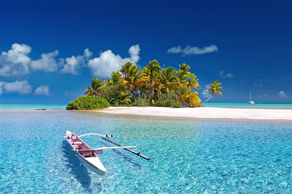
The South American aquatic system is long, meandering and has a number of characteristic features. It is based on the Amazon - the main river of the continent, and also the deepest in the whole world. The humidity created by it and its numerous tributaries contributed to the emergence of a special ecosystem. The banks of the reservoirs are covered with rain forests, and almost half of their inhabitants are endemic, like the rarest species of crocodiles from Orinoco.
Rivers are important transport arteries in the region. Shipping on them is especially active after the rainy season. Hydroelectric power plants have been built on large reservoirs, so they also provide the region with electricity. Madeira, Paraguay and other rivers not only belong to more than one country, but also serve as state borders for them.
The longest rivers in South America
List of the largest rivers on the mainland.
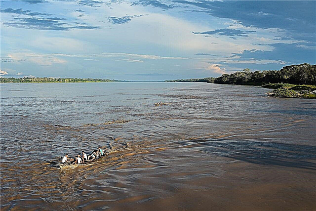
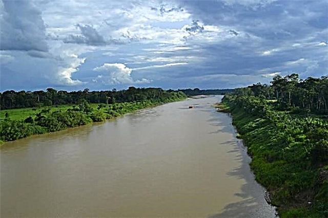
Amazon
It flows through Brazil, Peru and Colombia. More than half of them are navigable. The deepest river in the world. Due to the moisture created in its basin, tropical forests appeared, and in them many species of living organisms. Therefore, the Amazon is considered the world's genetic fund. River travel is a popular pastime among tourists, but it is fraught with dangers in some areas.
The length of the river is 7100 km.

Parana
Belongs to the territory of three countries: Brazil, Argentina and Paraguay. There is controversy about the translation of the name. Among the options: "river of misfortune" and "mother of the sea". Parana is crossed by several bridges, including the "Bridge of Friendship": on one side there is the Brazilian city of Foz do Iguacu, on the other - the Paraguayan Ciudad del Este. The river is used as a source of fresh water for shipping; hydroelectric power stations have been built on it.
The length of the river is 4380 km.

Zhurua
The right tributary of the Amazon carries its waters mainly through the lands of Brazil. The source is located in the foothills of the Peruvian Andes. Half the length is suitable for the passage of various types of vessels. Valuable for the oil deposits explored in the vicinity of the main channel. The middle course is densely populated. The best time for a tourist trip is from mid-winter to late spring, when the Zhurua is overflowing.
The length of the river is 3280 km.

Madeira
About 100 km runs along the state border of Brazil and Bolivia. The name translates as "wood". This is due to the nature of the area: the rainforests of the Amazon grow around. The water level fluctuates greatly depending on the season. It can differ by 12 meters. One of the unique local biological species is the Amazonian dolphin.
The length of the river is 3230 km.

Purus
Right tributary of the Amazon, which belongs to the territory of Brazil and Peru. Almost its entire length is navigable. It is famous for its riverbed, which is considered the most winding in the world. The banks are clayey and eroded from time to time. The river floods especially widely from the middle of spring. There are good rapids for rafting, as well as sandy beaches near cities.
The length of the river is 3200 km.
Tocantins
Brazilian river that originates on the slopes of the Serra Dorada mountains. It is conventionally divided into two parts: the first is rapids, the second is navigable. The food is mainly rain-fed. A cascade of several dams has been built on Tocantins. The river is used to generate electricity. More than a dozen large settlements are located directly on the coast.
The length of the river is 2850 km.

San Francisco
It flows in Brazil and plays a particularly important role in the arid savannah area of Caatinga: there are no other sources of drinking water there. A cascade of hydroelectric power plants has been built. There are two navigable sections. In terms of tourism, hiking excursions along the coast, hiking for several days along paved routes, watching waterfalls, as well as extreme kayaking and canoeing are popular.
The length of the river is 2830 km.

Orinoco
Belongs to the lands of Colombia and Venezuela. Initially, when exploring the river, its source was incorrectly identified. The correct data was entered into the register only in 1951. Orinoco is famous as the habitat of the rarest crocodile species named after the river. Amazonian dolphins are also found here. The world's largest reserves of heavy oil have been explored in the vicinity.
The length of the river is 2730 km.

Araguaya
The Brazilian river flows through the plateau. Araguay is home to one of the largest river islands in the world. Bananal area - 19162 km². The navigable section of the river is the middle course. The lower reaches are rapids and partly suitable for rafting. The coast is picturesque in places: subequatorial forests are replaced by savannas, and those, in turn, by gallery forests belonging to evergreens.
The length of the river is 2630 km.

Paraguay
Belongs to the territory of Brazil and Paraguay, on one of the sites it serves as the state border between these countries. It is the right tributary of the Parana. During a drought period, numerous shallow tributaries become small lakes, and the main channel becomes shallow. The river divides Paraguay into two parts. At the same time, the western coast is sparsely populated, and 98% of the population settled on the eastern one.
The length of the river is 2500 km.

Rio Negro
The largest left tributary of the Amazon belongs to the territory of three countries: Brazil, Venezuela, Colombia. The name translates as "black river". This name was chosen because of the distinct brown tint of the water, which in some periods becomes dark. The water level fluctuates greatly throughout the year, and the seasonal flood of the Rio Negro reaches 35 km wide.
The length of the river is 2300 km.

Uruguay
The river begins in Brazil, runs along the border with Uruguay and rushes towards Argentina. The translation of the name is “the river of colorful birds”. The city of Salto divides the waterway into two parts: rapids and navigable. Several ports have been built on the coast. Provides settlements not only with drinking water, but also with electricity at the expense of hydroelectric power plants.
The length of the river is 2200 km.

Tapajos
Right tributary of the Amazon, belonging to the territory of Brazil. The location of the rainforests on both banks is noteworthy: on the right - mainly the moist forests of Tapajos Xingu and the dry tropical forests of Mato Grosso, and on the left - the humid forests of Madeira-Tapajos. Attractions of the area: South America point of inadmissibility and the national park "Amazonia".
The length of the river is 2200 km.

Mamore
Belongs to the territory of Brazil and Bolivia. The coast of the river is forests and savannahs. From a bird's eye view, the Mamore channel is difficult to mistake for a river, it is so meandering and the turns are steep. It merges with Beni and forms Madeira. In the lower reaches there are many rapids, upstream the river is navigable, like most of its tributaries. Even in the era before Columbus, this area was densely populated.
The length of the river is 2000 km.

Japura
In Colombia, it is called Caqueta. Part of the river is also found in Brazil. It is a left tributary of the Amazon and originates in the Central Cordillera. During floods, it overflows so much that lakes are formed in the valley. Most of the riparian forests have been cleared and converted into pasture or cropping areas. Large species of fish and many reptiles live in the waters of Japura.
The length of the river is 2000 km.

Shingu
Brazilian right tributary of the Amazon. Rain feeding contributes to the flooding of the river from early autumn to mid-spring. Navigation is only available at 10% of the total length. There are many large rapids and waterfalls. The most famous of them is Cachueira Grande. The banks of the river are covered with rainforests of the Amazon. The national park of the same name is located in the upper reaches of the Xingu.
The length of the river is 1980 km.

Ucayali
A river in Peru, whose mouth, the Amazon, is sometimes mistaken for its source. Formed as a result of the confluence of two rivers. The channel is replete with bends and bends. In this case, navigation is available along the entire length. The area around is mixed: there are wetlands, and there are also covered with dense forests. A unique phenomenon of Ucayali is the "singing" of fish.It has found its reflection in several scientific works.
The length of the river is 1950 km.

Marañon
Peruvian river of the Amazon water system. It originates from the glacial lakes near Mount Erupakha. Most of the channel runs in mountainous terrain, hence the rapid current. The area is characterized by an abundance of canyons and gorges. Suitable for extreme tourism lovers: a trip to the Marañon River valley requires some preparation and experience of such excursions.
The length of the river is 1600 km.

Apure
Venezuelan river, left tributary of the Orinoco. One of the states of the country bears the same name. It originates in the mountains of the Cordillera de Merida. There are two periods in terms of navigation. During the rainy season it is navigable almost along its entire length, the rest of the time - only in some areas. It floods especially strongly from May to the end of autumn. At this time, it becomes the main transport artery of the region.
The length of the river is 1580 km.

Putumayo
The left tributary of the Amazon, flowing in Brazil, Ecuador, Peru and Colombia. At the turn of the 19th and 20th centuries, a lot of natural rubber was mined here. The craft has survived, but on a smaller scale. It is navigable almost along the entire river bed, and is an important transport artery, given the dense, impenetrable forests around. Cattle are raised in the Putumayo Valley.
The length of the river is 1580 km.

Magdalena
Colombian river originating in the Andes. Refers to the water system of the Caribbean Sea, into which it flows. The main navigable river in the country. Since the majority of the population lives in the Magdalena Valley, the coast is being actively developed. Deforestation for the creation of pastures and farmland leads to the disappearance of species of flora and fauna, as well as to the deterioration of the environment.
The length of the river is 1550 km.

Guaporé
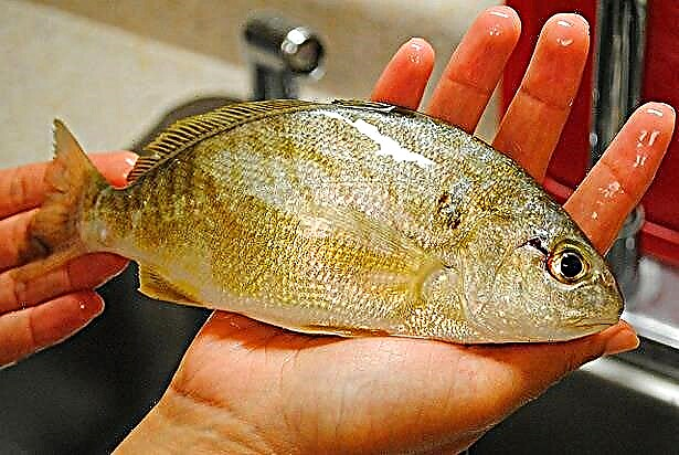
It flows in Brazil and Bolivia, in one of the sections it serves as the border between these countries. There are about 260 species of fish in the river, 25 of them are endemic. Some species, such as golden dorado, are harvested commercially and exported. The ichthyofauna is predominantly Amazonian, but there are also representatives characteristic of the Paraguay River. There is a biosphere reserve nearby.
The length of the river is 1550 km.

Beni
Bolivian river, the length of which is debated. It is difficult to measure the length of the river due to the meandering channel, the abundance of rapids and changes in the direction of the current. This contributes to the emergence of curious natural objects such as gorges. Beni, together with other rivers, merges and forms Madeira. On the banks of the Beni, the events of the biographical novel by Yossi Ginsberg took place, which became a film in 2017.
River length - 1500 km

Parnaiba
A wide delta is formed at the mouth of the river. This area has become a protected natural area since the mid-90s of the last century. Another important natural site is the Serra das Confucions National Park. The number of fish species inhabiting Parnaib is over 140. Slightly less than half of them are endemic. Rare birds, including red ibises, nest in mangrove forests.
The length of the river is 1450 km.

Madre de Dios
Belongs to the Amazon basin and flows through Bolivia and Peru. The navigable part of the river begins below the city of Puerto Maldonado, where a large port is built. The river valley is actively used for agriculture, including the cultivation of mangoes. Gold is also being mined, which negatively affects the environment. National parks and conservation areas are established on Madre de Dios.
The length of the river is 1450 km.

Rio Grande
Bolivian river, formed by the confluence of two mountain streams. It is the right tributary of the Mamore. The river bed passes through at least four natural zones. Both arid areas and rainforests can be found here. The terrain is also heterogeneous: mountain ranges are replaced by lowlands, and vice versa. One third of the country's population lives within the river basin.
The length of the river is 1438 km.

Cauca
The Colombian River originates in the Andes, and flows into the Magdalena, becoming its right tributary. About a quarter of the total population of the country lives in the river valley. The territory is separated from the valleys of other rivers by the large uplands of the Cordilleras. To meet the needs of the region and to control the Kauka level, the large Salvakhina reservoir was built.
The length of the river is 1350 km.

Iguazu
It flows in Argentina and Brazil. The translation of the name is "big water". The channel is curved in places, it winds especially strongly in the upper reaches. The main attraction of the river is the cascade of waterfalls of the same name. In total, there are about 70 of them. The best view on them opens from the Brazilian side. In 1984, the Iguazu Falls were included in the UNESCO World Heritage List.
The length of the river is 1320 km.

Rio Negro
It flows in Argentine Patagonia and flows into the Atlantic Ocean. Navigable in selected areas. The Rio Negro Valley is home to extensive agricultural land. About 2/3 of all pears and apples in the country are grown here. The longest kayak regatta in the world is held on the river. It covers half of the channel. The famous El Condor resort is located near the mouth.
The length of the river is 1300 km.

Rio Grande
The tributary of the Parana is a Brazilian river, navigable in some parts. A hydroelectric power station and a cascade of reservoirs were built on it. In terms of tourism, the upper reaches of the Rio Grande are more interesting: there you can see numerous waterfalls and take part in rafting. There are sections with small rapids suitable for beginners. The river is full of water from mid-winter to March.
The length of the river is 1230 km.